
Christchurch to Queenstown campervan route
The drive from Christchurch to Queenstown is one of the great South Island road trips, and a near-perfect first leg in a campervan, motorhome or caravan. In a single inland sweep it takes you from the Canterbury Plains up through the turquoise lakes and golden tussock of the Mackenzie Country, over two alpine passes, and down into the mountains around Queenstown. It's very doable in a long day, but it's far better spread over two or three with an overnight in the Mackenzie. Here's how to plan it for a big rig — the route, the stops, the campsites, and the bits that catch tourers out.
- Distance
- ~480 km via the inland State Highway 8 route
- Driving time
- ~6 hours in a car; plan ~7 hours plus stops in a campervan, motorhome or with a caravan
- Suggested days
- 2–3 days to enjoy it (1 long day is possible)
- Main route
- SH1 → SH79 → SH8 via Geraldine, Lake Tekapo, Twizel, Omarama, the Lindis Pass and Cromwell
- Best time
- Nov–Apr for lupins and long days; Jun–Sep is alpine — carry chains
The short version
- Take the inland SH8 route via Lake Tekapo and the Lindis Pass — it's the scenic one most tourers take.
- Break the drive in the Mackenzie — Lake Tekapo, Twizel or Omarama all make great overnight stops.
- Big rig or towing? Skip the Crown Range at the Queenstown end — go via Cromwell and the Kawarau Gorge instead.
- Two alpine passes (Burkes and the Lindis) mean winter snow and ice — carry chains Jun–Sep and check road conditions.
- The Mackenzie is windy and exposed — check gusts before driving a tall rig.
Which route: inland (SH8) or coastal (SH1)?
There are two ways south. The inland route via State Highway 8 is the classic: roughly 480 km from Christchurch through Geraldine and Fairlie, over Burkes Pass into the Mackenzie, past Lake Tekapo and Lake Pukaki, through Twizel and Omarama, over the Lindis Pass to Cromwell, and on to Queenstown. It's about six hours of driving in a car and the scenery is the whole point.
The coastal route via State Highway 1 heads south down the east coast through Timaru and Oamaru before cutting inland — it's slightly longer (closer to 6¾ hours) and less dramatic, but a good option if you want to take in the Waitaki Valley or you're continuing a coastal loop. For most campervan and caravan trips, the inland SH8 route is the one to take, and it's the one this guide follows.
The drive, leg by leg
Christchurch → Lake Tekapo (~3 hours, ~225 km)
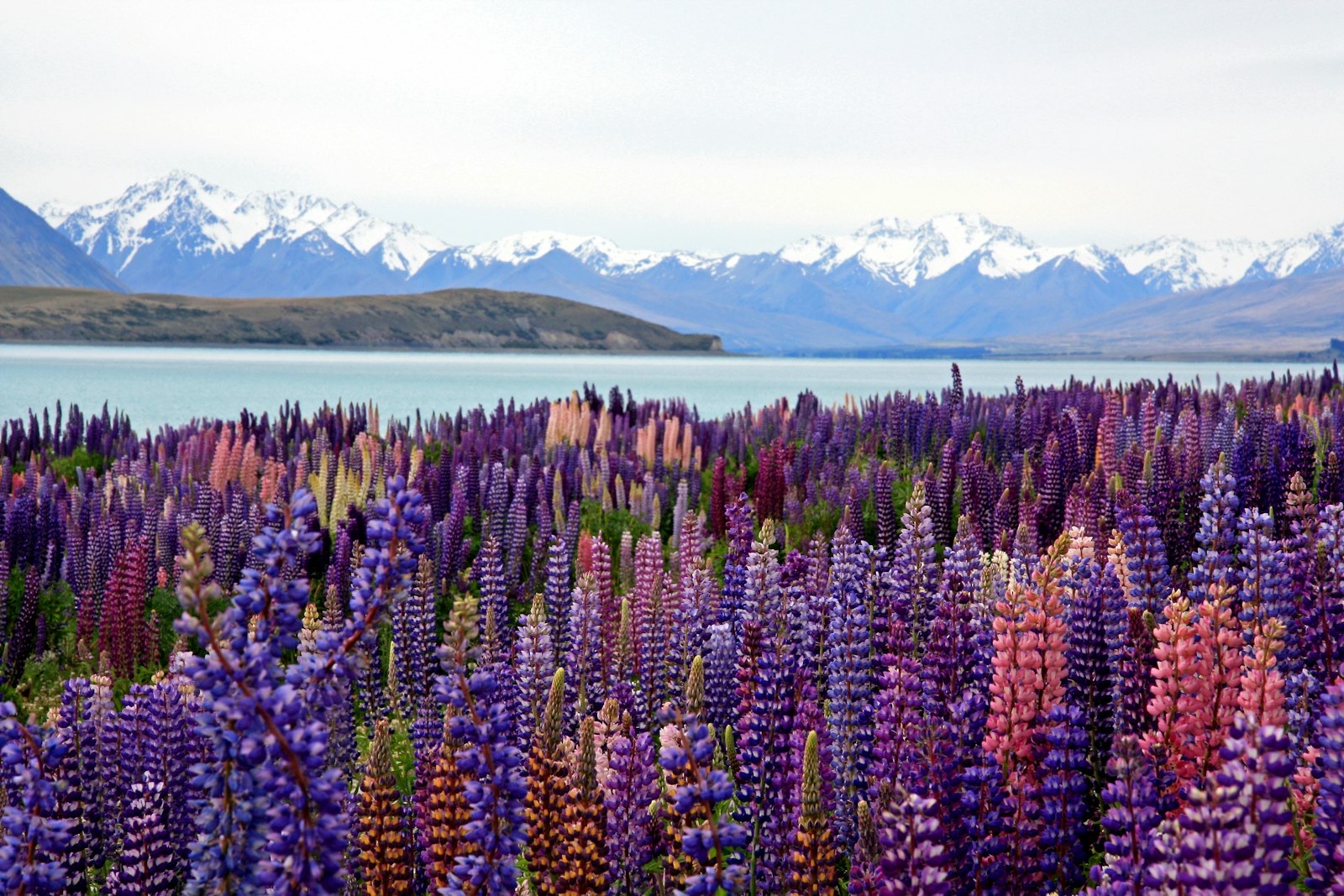
Out of Christchurch the road crosses the flat Canterbury Plains — easy driving to settle into the rig — before the country lifts at Geraldine (a good coffee and pie stop) and Fairlie. From Fairlie you climb Burkes Pass, a semi-alpine saddle that can be cold, foggy and icy in winter, and drop into the wide, dry Mackenzie Basin. The first sight of Lake Tekapo — that almost unreal milky-turquoise water against the mountains — is one of the great reveals on any New Zealand drive.
Lake Tekapo → Twizel → Omarama (~1 hour, ~70 km)
South of Tekapo, detour to the Lake Pukaki lookout for the postcard view straight up the lake to Aoraki / Mount Cook — and, if you have a day to spare, the side trip up to Mount Cook Village is well worth it. Carry on through Twizel and down to Omarama, with the Clay Cliffs and the famous hot tubs nearby. Any of these three towns makes a comfortable overnight.
Omarama → Cromwell → Queenstown (~2½ hours, ~185 km)
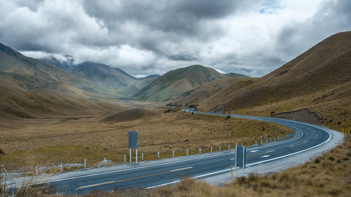
From Omarama the highway climbs the Lindis Pass (971 m), a sweeping run through bare golden hills that's a highlight in its own right, then descends to the Clutha and the orchard town of Cromwell. From Cromwell it's into the dramatic Kawarau Gorge and along to Queenstown — your first glimpse of Lake Wakatipu and The Remarkables is the payoff for the whole drive.
Big rig or towing? Mind the Crown Range
Where to stay: camps along the way
The Mackenzie towns are well set up for tourers:
- Lake Tekapo — holiday parks in town, plus it's an International Dark Sky Reserve, so it's worth staying the night for the stargazing. Note that freedom camping is banned in the township and along the lakefront.
- Twizel — a holiday park in town and the free Lake Poaka DOC campsite nearby (a simple, quiet site, four-night maximum), handy as a base for the Mount Cook detour.
- Lake Pukaki — "The Pines" overnight area is for self-contained vehicles only and fills fast in summer, but the morning view up to Aoraki is hard to beat.
- Omarama — a Top 10 holiday park in town, with the hot tubs to soak off the drive.
Winter & alpine conditions
This is genuine alpine country. Burkes Pass, the Lindis Pass and the Crown Range get snow, ice and black ice from roughly June to September, and the Lindis and Crown Range can close after heavy snowfalls. If you're driving in winter: carry snow chains and know how to fit them (they're sometimes legally required), slow right down on frosty mornings and in shaded corners, use low gear to engine-brake on the descents rather than riding the brakes, and check the NZTA Waka Kotahi road conditions before you set off. Never drive onto a pass that's closed, or where chains are required and you don't have them.
Wind in the Mackenzie
The open Mackenzie Basin, the Lindis and the exposed lakefront sections can get strong, gusty nor'westers that buffet tall, slab-sided campervans and caravans and can start a sway. Because the forecast headline wind speed hides the gusts that actually move a high-sided vehicle, check a briefing that reports gusts before exposed legs, slow down in strong wind, and keep a firm but relaxed grip — and be ready for a shove when you pass a truck or come out from behind shelter.
Check the wind before the Mackenzie → The free Touring Brain weather briefing flags gusts at cab height — not just the headline wind speed — so you can decide whether to drive, wait or reroute the exposed legs.Frequently asked questions
How long does it take to drive from Christchurch to Queenstown?
About six hours of pure driving via the inland SH8 route, but in a campervan, motorhome or with a caravan, plan closer to seven hours plus stops — the rig is slower, there are two passes to climb, and you'll want to stop for the views. It's doable in one long day, but an overnight in the Mackenzie makes it a much better trip.
Can you do this drive with a caravan?
Yes — the inland SH8 route is well suited to towing, with good roads and gentle grades for most of the way. The one thing to plan around is the finish: take the Cromwell / Kawarau Gorge route into Queenstown, not the Crown Range, if you're towing or in a large motorhome.
What's the best time of year for this trip?
November to April gives you long days, warm weather and (in December) the famous lupins around Tekapo and Pukaki. June to September is winter: beautiful and quieter, but the passes are alpine, so carry chains and watch the road reports.
Sources & further reading: road conditions and winter chain requirements — NZTA Waka Kotahi Journey Planner; campsites and freedom-camping rules — Department of Conservation; mountain weather and wind — MetService. Distances and times are approximate and were last reviewed on 19 June 2026.
This guide is general touring information, not legal or driver-training advice, and conditions change quickly. Always follow road signs, current speed limits and NZTA Waka Kotahi guidance, check road and weather conditions before alpine routes, confirm campsite availability and bylaws before you arrive, and drive to the conditions on the day. Touring Brain is independent and not affiliated with NZTA, DOC or any rental operator.
Photos: Lake Tekapo — Nareeta Martin; high country — James Pere; Queenstown — Peter Luo (Unsplash).