
Nelson to the West Coast via the Buller Gorge
The drive from Nelson to the West Coast down the Buller Gorge is one of the South Island's most characterful runs — a river road that winds through bush-clad gorges to the wild coast and the famous Pancake Rocks at Punakaiki. It's a great trip in a caravan or motorhome, with a couple of narrow stretches to take steadily. Here's the route, the stops, and what to know before you tow into the gorge.
- Distance
- ~225 km Nelson → Westport; ~290 km on to Greymouth via Punakaiki
- Driving time
- ~3 hours to Westport; a relaxed full day to Greymouth
- Route
- Nelson → Murchison → Buller Gorge → Westport → Punakaiki → Greymouth (SH6)
- Watch for
- The narrow, slip-prone gorge and the one-lane Hawks Crag
- Best time
- Year-round; check road status — the gorge is slip-prone in heavy rain
The short version
- Take the Buller Gorge steadily — it's narrow and winding, and slip-prone in heavy rain.
- Hawks Crag is a one-lane overhang — slow right down and give way to oncoming traffic.
- Check the road status before you go — the gorge can drop to one lane or close after slips.
- Murchison is the halfway stop — rafting, the Buller swingbridge, and a good overnight.
- Time Punakaiki for high tide — the Pancake Rocks blowholes are best then.
The drive, leg by leg
Nelson → Murchison (~1.5 hours, ~125 km)
From Nelson, State Highway 6 runs through Richmond and over the Spooner Range and Hope Saddle to Murchison — about the halfway point, a friendly little town known for white-water rafting and the Buller Gorge Swingbridge, the longest in the country. A good place to stretch the legs or stay the night.
The Buller Gorge → Westport (~1.5 hours, ~100 km)
Below Murchison the road follows the Buller River through the Upper and Lower gorges — beautiful, narrow and winding, with the river right beside you. This is the stretch to take steadily (see below) before the country opens out at the coast and the old coal town of Westport, with the Cape Foulwind seal colony nearby.
The coast: Westport → Punakaiki → Greymouth (~1.5 hours, ~100 km)
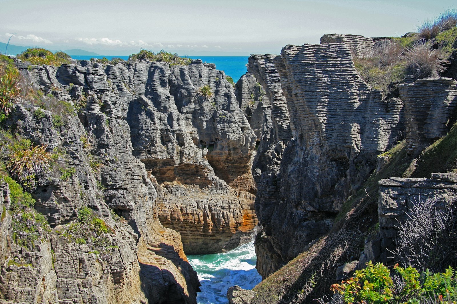
South of Westport the road hugs the wild coast to Punakaiki and the extraordinary Pancake Rocks — layered limestone stacks with blowholes that erupt at high tide — then carries on to Greymouth, the main West Coast town.
The stretch to take steadily: the Buller Gorge
Where to stay
- Murchison — holiday parks at the halfway mark; a relaxed first night.
- Westport — holiday parks at the coast, near Cape Foulwind.
- Punakaiki — camp right by the Pancake Rocks and the wild coast.
- Greymouth — holiday parks at the end of the drive.
Frequently asked questions
Can a big motorhome drive the Buller Gorge?
Yes — it's a sealed highway and motorhomes drive it regularly. Just take it steadily through the narrow, winding sections, slow right down at Hawks Crag's one-lane overhang, and check the road status, as slips can cause one-lane restrictions.
Is the West Coast wet?
Very — it's one of the wettest parts of the country, and heavy rain is what triggers slips in the Buller Gorge. Check the forecast and road status, and pick a settled day for the gorge if you can.
Where does this route lead?
On down the West Coast — Hokitika, the glaciers and the Haast are all south of Greymouth, and Arthur's Pass climbs back over to Christchurch from here.
Sources & further reading: Buller Gorge road status and conditions — NZTA Waka Kotahi Journey Planner; the Pancake Rocks, Cape Foulwind and West Coast parks — Department of Conservation (West Coast); weather — MetService. Distances and times are approximate and were last reviewed on 19 June 2026.
This guide is general touring information, not legal or driver-training advice, and conditions change quickly. Always follow road signs and NZTA Waka Kotahi guidance, check the road status before the Buller Gorge (slip-prone in heavy rain), give way at one-lane sections, confirm campsite availability and self-containment rules, and drive to the conditions on the day. Touring Brain is independent and not affiliated with NZTA, DOC or any operator.
Photo: Pancake Rocks, Punakaiki — Nareeta Martin (Unsplash).